More About
Fort lauderdale
The History of Fort Lauderdale
NOTE: The information below is boring to many, but others find it interesting. If you do choose to read it, be
warned that as in much of American History, there are some details that will be disturbing, but they are all true.
Fort Lauderdale is a city in the U.S. state of Florida, 25 miles north of Miami. It is the county seat and largest city of Broward County.
As of 2019 census bureau estimates, the city has an estimated population of 182,437. Fort Lauderdale is a principal city of the Miami metropolitan area,
which was home to an estimated 6,198,782 people in 2018.
The city is a popular tourist destination, and Yachting Capital of the World, with an average year-round temperature of 75.5 °F (24.2 °C) and 3,000 hours of
sunshine per year. Greater Fort Lauderdale, encompassing all of Broward County, hosted 13 million overnight visitors in 2018. There were over 560 hotels,
and nearly 36,000 hotel rooms. From that, the county collected nearly $87 million from its 5% hotel development tax it charges. Additionally, 3.89 million
cruise passengers passed through its Port Everglades, making it the 3rd largest cruise port in the world. Greater Fort Lauderdale has over 4,000
restaurants, 63 golf courses, 12 shopping malls, 16 museums, 132 nightclubs, 278 parkland campsites, and 100 marinas housing 45,000 resident yachts.
Fort Lauderdale is named after a series of forts built by the United States during the Second Seminole War. The forts took their name from Major William
Lauderdale (1782–1838), younger brother of Lieutenant Colonel James Lauderdale. William Lauderdale was the commander of the detachment of soldiers who built
the first fort. Development of the city did not begin until 50 years after the forts were abandoned at the end of the conflict.
Three forts named “Fort Lauderdale” were constructed: the first was at the fork of the New River, the second was at Tarpon Bend on the New River between the
present-day Colee Hammock and Rio Vista neighborhoods, and the third was near the site of the Bahia Mar Marina.
The area in which the city of Fort Lauderdale would later be founded was inhabited for more than two thousand years by the Tequesta Indians.[16] Contact with
Spanish explorers in the 16th century proved disastrous for the Tequesta, as the Europeans unwittingly brought with them diseases, such as smallpox, to which
the native populations possessed no resistance. For the Tequesta, disease, coupled with continuing conflict with their Calusa neighbors, contributed greatly
to their decline over the next two centuries. By 1763, there were only a few Tequesta left in Florida, and most of them were evacuated to Cuba when the
Spanish ceded Florida to the British in 1763, under the terms of the Treaty of Paris (1763), which ended the Seven Years’ War. Although control of the
area changed between Spain, United Kingdom, the United States, and the Confederate States of America, it remained largely undeveloped until the 20th century.
The Fort Lauderdale area was known as the “New River Settlement” before the 20th century. In the 1830s there were approximately 70 settlers living along the
New River. William Cooley, the local Justice of the Peace, was a farmer and wrecker, who traded with the Seminole Indians. On January 6, 1836, while Cooley
was leading an attempt to salvage a wrecked ship, a band of Seminoles attacked his farm, killing his wife and children, and the children’s tutor. The other
farms in the settlement were not attacked, but all the white residents in the area abandoned the settlement, fleeing first to the Cape Florida Lighthouse
on Key Biscayne, and then to Key West.
The first United States stockade named Fort Lauderdale was built in 1838, and subsequently was a site of fighting during the Second Seminole War. The
fort was abandoned in 1842, after the end of the war, and the area remained virtually unpopulated until the 1890s. It was not until Frank Stranahan arrived
in the area in 1893 to operate a ferry across the New River, and the Florida East Coast Railroad’s completion of a route through the area in 1896, that
any organized development began. The city was incorporated in 1911, and in 1915 was designated the county seat of newly formed Broward County.
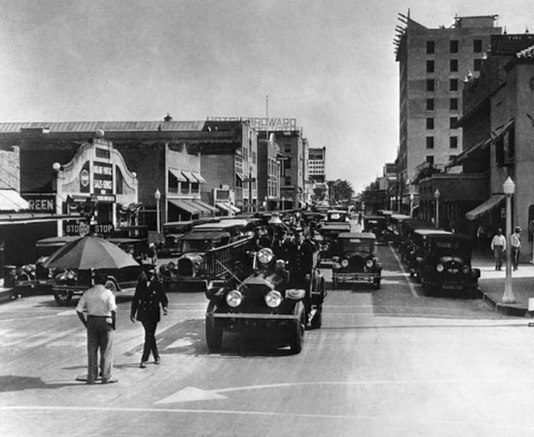
Fort Lauderdale’s first major development began in the 1920s, during the Florida land boom. The 1926 Miami Hurricane and the Great Depression of the
1930s caused a great deal of economic dislocation. In July 1935, an African-American man named Rubin Stacy was accused of robbing a white woman at knife point.
He was arrested and being transported to a Miami jail when police were run off the road by a mob. A group of 100 white men proceeded to hang Stacy from a tree
near the scene of his alleged robbery. His body was riddled with some twenty bullets. The murder was subsequently used by the press in Nazi Germany to
discredit U.S. critiques of its own persecution of Jews, Communists, and Catholics.
When World War II began, Fort Lauderdale became a major U.S. base, with a Naval Air Station to train pilots, radar operators, and fire control operators.
A Coast Guard base at Port Everglades was also established.
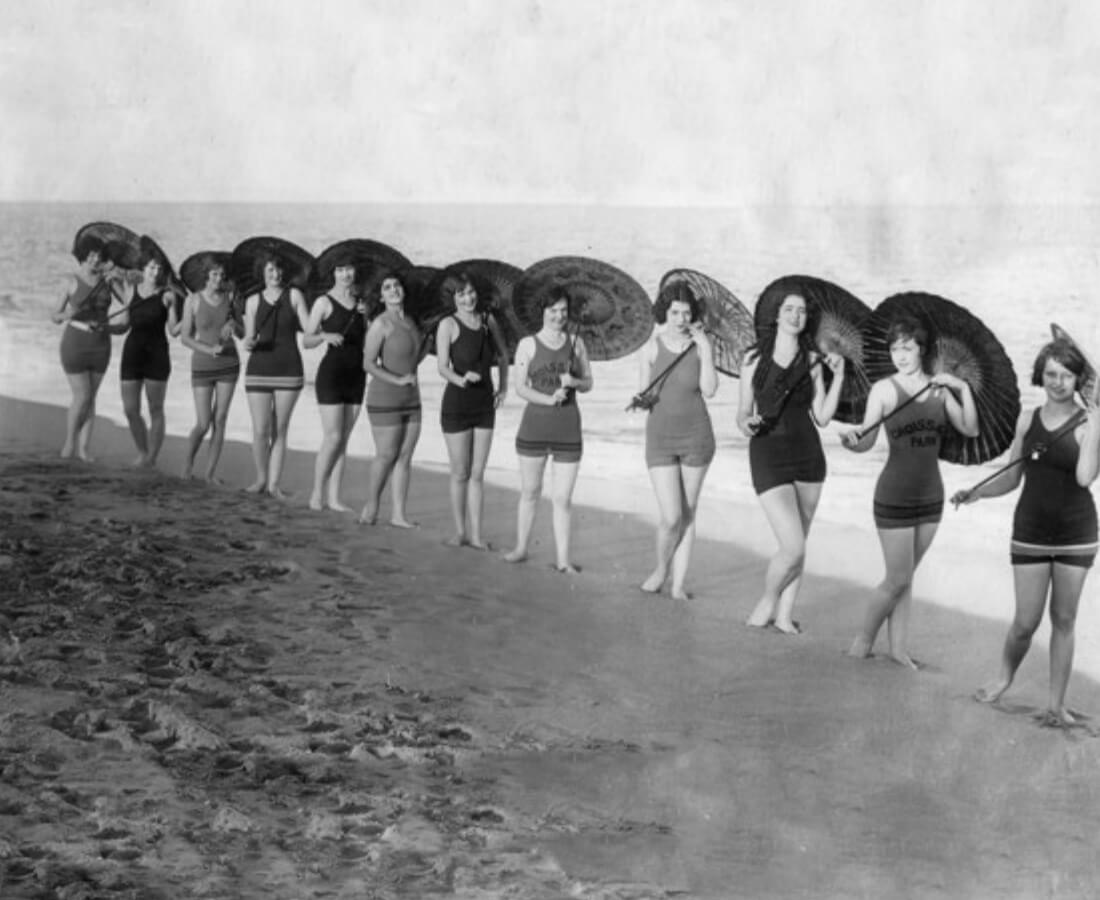
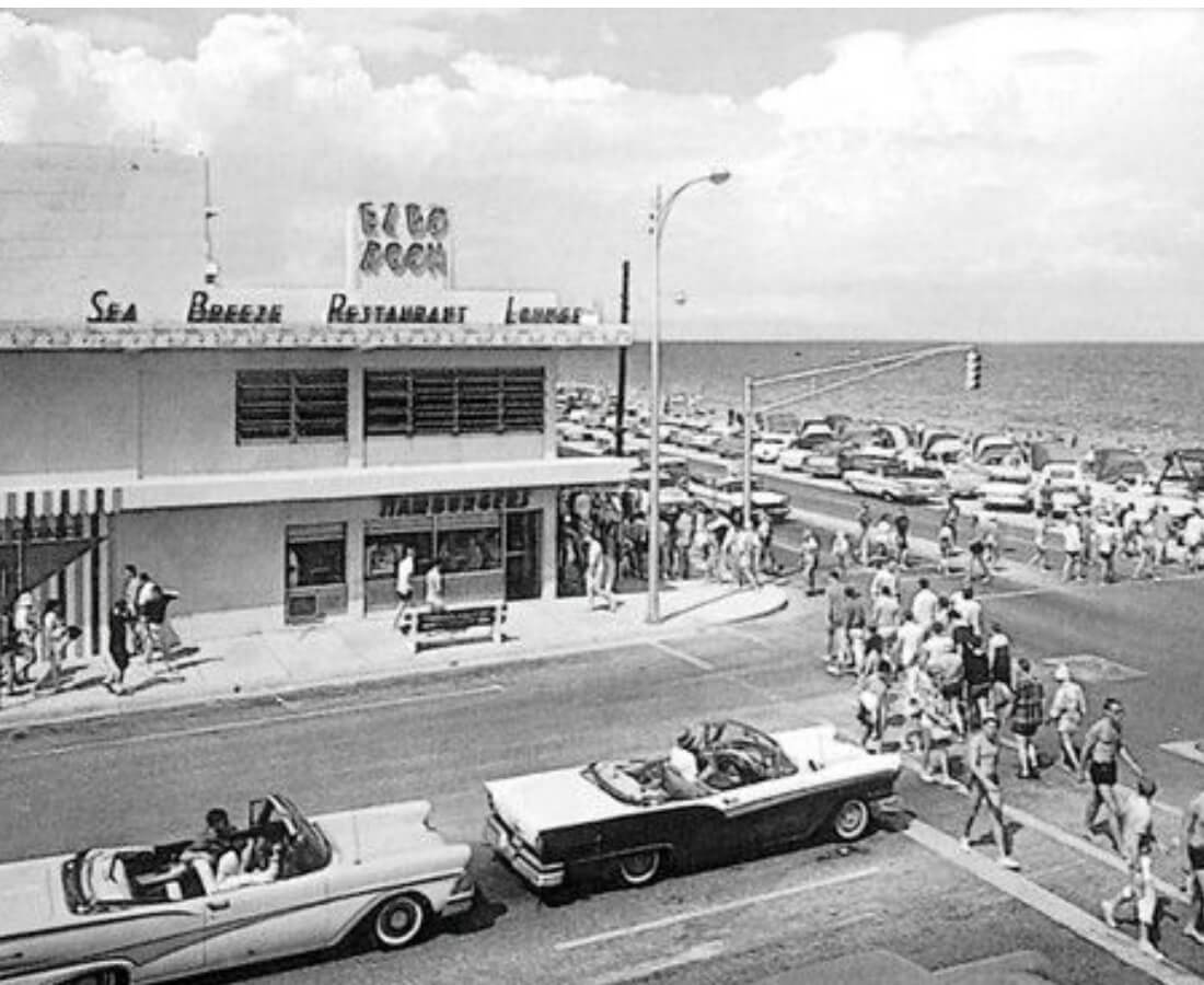
Until July 1961 only whites were allowed on Ft. Lauderdale beaches. There were no beaches for African-Americans in Broward County until 1954, when “the
Colored Beach”, today Dr. Von D. Mizell-Eula Johnson State Park, was opened in Dania Beach; however, no road was built to it until 1965. On July 4, 1961,
African Americans started a series of wade-ins as protests at beaches that were off-limits to them, to protest “the failure of the county to build a road
to the Negro beach”.On July 11, 1962 a verdict by Ted Cabot went against the city’s policy of racial segregation of public beaches, and
Broward County beaches were desegregated in 1962.
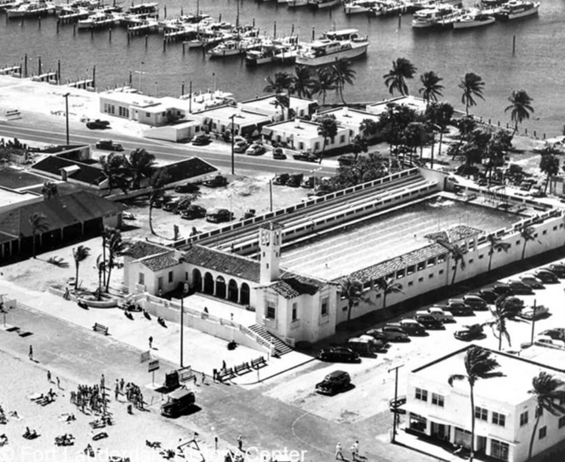
Today, Fort Lauderdale is a major yachting center, one of the nation’s largest tourist destinations, and the center of a metropolitan division with
1.8 million people.
Population size
After the war ended, service members returned to the area, spurring an enormous population explosion that dwarfed the 1920s boom. The 1960 Census
counted 83,648 people in the city, about 230% of the 1950 figure. A 1967 report estimated that the city was approximately 85% developed, and the
1970 population figure was 139,590.
After 1970, as Fort Lauderdale became essentially built out, growth in the area shifted to suburbs to the west. As cities such as Coral Springs,
Miramar, and Pembroke Pines experienced explosive growth, Fort Lauderdale’s population stagnated, and the city actually shrank by almost 4,000
people between 1980, when the city had 153,279 people, and 1990, when the population was 149,377. A slight rebound brought the population
back up to 152,397 at the 2000 census. Since 2000, Fort Lauderdale has gained slightly over 18,000 residents through annexation of seven
neighborhoods in unincorporated Broward County.
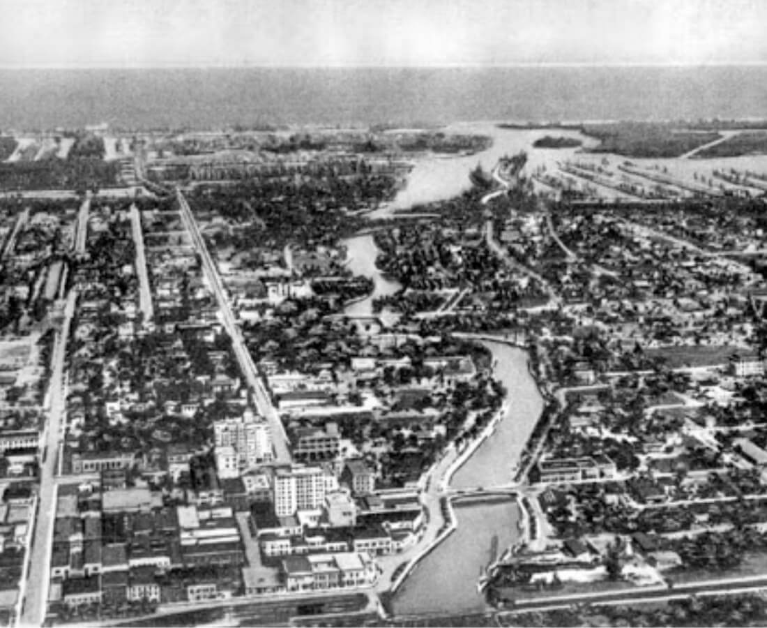
According to the United States Census Bureau, the city has a total area of 38.6 square miles (99.9 km2), 34.7 square miles (90.0 km2) of
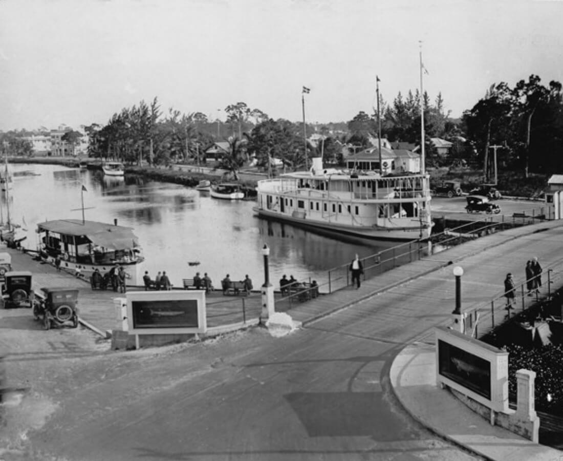
which is land and 3.8 square miles (9.9 km2) of which is water (9.87%).[35] Fort Lauderdale is known for its extensive network of canals;
there are 165 miles (266 km) of waterways within the city limits.
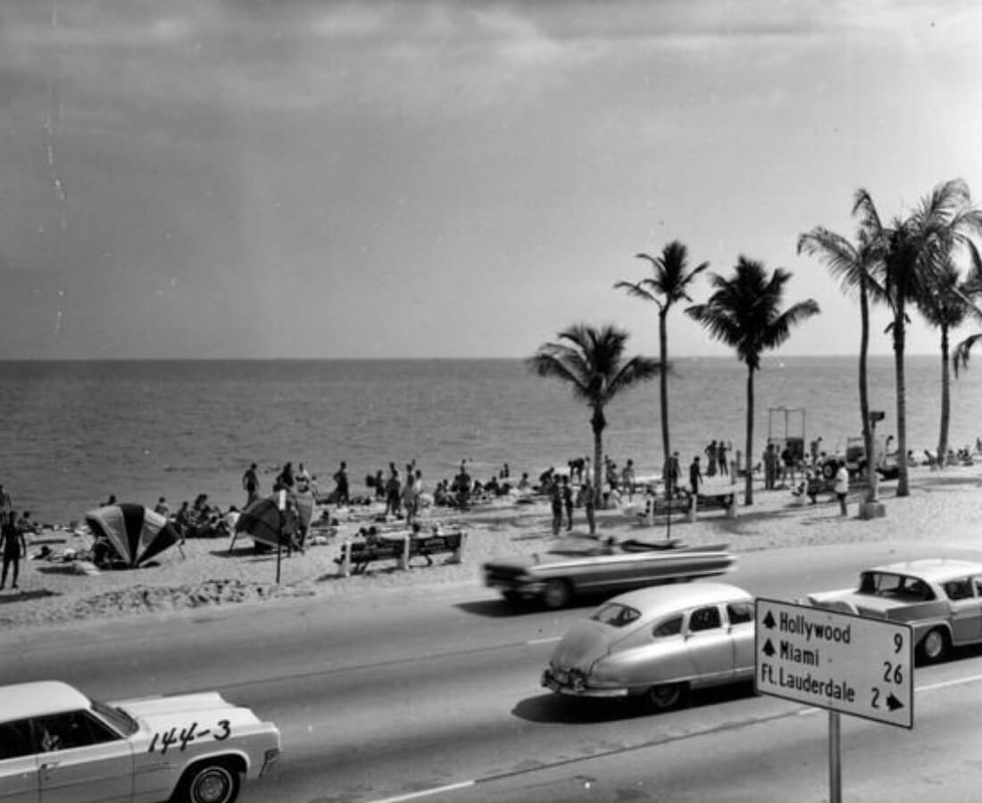
The city of Fort Lauderdale is adjacent to the Atlantic Ocean, includes 7 miles (11 km) of beaches,[37] and borders the following municipalities:
On its east:
Lauderdale-by-the-Sea
Sea Ranch Lakes
Victoria Park
On its south:
Hollywood
Dania Beach
On its southwest:
Davie
On its west:
Plantation
Lauderhill
Lauderdale Lakes
On its northwest:
North LauderdaleOakland ParkTamarac
On its north:
Wilton Manors
Pompano Beach
The northwestern section of Fort Lauderdale is separate from the remainder of the city, connected only by the Cypress Creek Canal as it flows under I-95.
This section of Fort Lauderdale borders the cities of Tamarac and Oakland Park on its south side. Oakland Park also borders Fort Lauderdale on the west side
of its northeastern portion. The greater portion of Fort Lauderdale in the south is bordered, along its north side by Wilton Manors.
Off the coast of Fort Lauderdale is the Osborne Reef, an artificial reef made of discarded tires that has proven to be an ecological disaster. The
dumping began in the 1960s, with the intent to provide habitat for fish while disposing of trash from the land. In the rugged and corrosive environment
of the ocean, however, nylon straps used to secure the tires wore out, cables rusted, and tires broke free. The tires posed a particular threat after
breaking free from their restraints. The tires then migrated shoreward and ran into a living reef tract, washed up on its slope and killed many things
in their path. In recent years, thousands of tires have also washed up on nearby beaches, especially during hurricanes. Local authorities are now working
to remove the 700,000 tires, in cooperation with the U.S. Army, Navy and Coast Guard.
Neighborhoods
See also: List of neighborhoods in Fort Lauderdale
Fort Lauderdale has a program for designating and recognizing neighborhoods. Under the Neighborhood Organization Recognition Program, more than 60
distinct neighborhoods have received official recognition from the city. An additional 25–30 neighborhoods exist without official recognition, although
the city’s neighborhood map displays them as well.
Climate
According to the Köppen climate classification, Fort Lauderdale has a trade-wind tropical rainforest (Köppen Af). While the city does not have
a true dry season, much of the seasonal rainfall comes between May and October. Winters are frequently dry and sunny, and drought can be a concern in
some years. (see climate chart below).
The wet season runs from May through October, and weather is typically hot, humid, and wet with average high temperatures of 86–90 °F (30–32 °C) and
lows of 71–76 °F (22–24 °C). During this period, more than half of summer days may bring brief afternoon or evening thunderstorms with lightning and
bursts of intense rainfall. The record high temperature of 100 °F (38 °C) was recorded on June 22, 2009.
The dry season often arrives some time in November and lasts through early to mid April. Seasonable weather is often warm, dry, and sunny. Average
high temperatures of 75–82 °F (24–28 °C) and lows of 59–67 °F (15–19 °C) are typical in the dry season. On rare occasion, cool fronts may make it
all the way south to Fort Lauderdale and the city will see a day or two of highs in the 60s °F (16-21 °C) and lows in the 40s °F (4-10 °C).
Rare frosts occur every few decades, and only once in recorded history have snow flurries been reported in the air, occurring on January 19, 1977.
During the dry season (winter), brush fires can be a concern in many years.
Annual average precipitation is 64.2 inches (1,630 mm), with most of it occurring during the wet season from May through October. However, rainfall
occurs in all months, even during the drier months from November through April. Fort Lauderdale has an average of 143 rain days and 250 sunshine
days annually. The hurricane season is between June 1 and November 30 with major hurricanes most likely to affect the city or state in September
and October. The most recent storms to directly affect the city were Hurricane Irma, in 2017, Hurricane Katrina and Hurricane Wilma, both
of which struck the city in 2005. Other direct hits were Hurricane Cleo in 1964, Hurricane King in 1950, and the 1947 Fort Lauderdale Hurricane.